Trekkers

  • Subscribe to our RSS feed.
  • Twitter
  • StumbleUpon
  • Reddit
  • Facebook
  • Digg

Friday, 31 October 2008

Introducing Google.org Geo Challenge Grants

Posted on 14:45 by Unknown
(Cross-posted from the Google.org blog)

At Google.org, we have met and worked with many amazing organizations over the past few years, and we keep hearing how eager people are to use online mapping tools such as Google Earth and Google Maps to tell their stories. There are tons of great mapping ideas out there, and we think that with a little support, many of them can come to life. So today, we’re excited to launch Google.org Geo Challenge Grants, a small grants program to provide nonprofits with the impetus and resources they need to take advantage of powerful and exciting online mapping tools.

Maps are a powerful way for organizations to display and share data, promote ideas and issues, and plan and organize activities. Online mapping tools can help the world visualize and understand information, problems, and solutions - whether in your town or village, or across the globe. They provide an easy-to-use interface with lots of detailed satellite imagery and other background data to put it all in context. We want to help organizations use these kinds of tools to advance their work in the areas of global development, climate change and global public health. Together with the Google Earth Outreach team, we piloted the program with a small number of organizations, asking ‘what kind of online mapping work could you do with a small grant?’ Every organization suggested a project that shares unique and useful information and tells a powerful story. Here is an example:

The Dreaming New Mexico initiative seeks to encourage adoption of clean electricity and to move New Mexico away from dirty, polluting power plants. Using the Google Earth API(browser plug-in), Dreaming New Mexico shows some of the choices available to New Mexico as it considers a move to sustainable clean energy. Click here to view the site.

We're now accepting applications from non-profit organizations around the world! Use your imagination and remember that many online mapping tools can be easy to learn and intuitive to use. Our first round of applications is open today and will close on December 22. We hope to continue with more grant rounds next year. Apply now!

Posted by David Bercovich, Project Manager, Google.org
Read More
Posted in Outreach | No comments

Thursday, 30 October 2008

How the US has voted since 1980

Posted on 11:15 by Unknown

In the final days of this captivating presidential election season, are you interested in knowing how US has voted in the past? Together with the Digital Scholarship Lab at University of Richmond, the Google Earth team has mapped historical election results in Google Earth and Google Maps. These maps show how the population has voted in past presidential elections from 1980 through 2004, and include election results at both the state and county levels. The maps also include demographic information derived from the 1980, 1990, and 2000 US Census.

Download this KML to Google Earth. You can also animate the election results over time.

Follow these steps:
  1. Check on "Animate US Presidential Election Results", the last item in the KML folder.
  2. A Time Slider will appear on the upper right corner of Google Earth screen:
  3. Click on the clock icon on the left hand side of the time slider to open up the "Time" option window; adjust the Animation speed to be faster. Click OK.
  4. Hit the play button on the right and watch how voting patterns have changed over time from 1980 -2004!

We also developed an embeddable Google Map, which can be viewed at this page. If you like the map, you can also add it to your website by clicking on the "Embed This Map" button and customize how it looks on your site.

Here are some of the interesting things we found by exploring these historical voting maps. Florida was a key state in 2004 presidential election between George W. Bush and John Kerry. You can check how each county voted in 2004 and then try to make your own projections of which way they will go this time.

Back in 1984, 49 states went to incumbent Ronald Reagan, with Walter Mondale only winning Minnesota, a state he previously represented and grew up in. You can view the voting breakdown for the state, and see what the margin was:


If you want to see more US election related news and maps, visit the Google Election page and Google Election 08 Map Gallery. There are more fun maps to browse, news to read, and useful tools to help you to stay informed.

Posted by Pete Giencke, Guirong Zhou, Wei Luo, Google Earth Team
Read More
Posted in | No comments

La Dolce Vista - Street View comes to Italy

Posted on 09:30 by Unknown

Right on the heels of Tuesday's rollout in Spain, you can now enjoy the beautiful Italian cities of Rome, Florence and Milan (where I previously lived!) with Street View. This new imagery for Italy also captures some of the stunning views along the shores of Lake Como. 


View Larger Map


View Larger Map

Rome was the heart of the Roman Empire and the beautiful ancient architecture that remains attracts millions of tourists every year.  Now enthusiasts of history and architecture, or even those looking to plan a romantic holiday, can enjoy exploring the spectacular ancient sites such as the Roman Colosseum, The Pantheon and Trajan's Column.


Visualizzazione ingrandita della mappa


Visualizzazione ingrandita della mappa


View Larger Map

I used to live in Milan and it is great fun to tour the city and revisit some favorite haunts.  Here you can see the tram I used to get to work in the morning, which happens to be the same type that I take these days along Market Street in San Francisco (the city bought some of their tram cars from Milan).  


Visualizzazione ingrandita della mappa

I also loved the navigli, canals that reminded me of my hometown Venice:


Visualizzazione ingrandita della mappa

I could go on and on about all of my favorite places and my trip down memory lane, but instead I will let the pictures speak for themselves:


Posted by Marco Zennaro, Software Engineer, Street View
Read More
Posted in Street View | No comments

Wednesday, 29 October 2008

Getting around Montréal, past and present

Posted on 13:00 by Unknown

Montréal has always been a great city for public transportation. In a way, it's responsible for my love of public transit. One of my earliest memories is of riding the bus around Montréal with my grandparents. They didn't have a car; in Montréal, they didn't need one. I still remember how excited I was waiting to ring the bell for our stop. I was so short that I had to stand on the seat to reach for it. Montréal's extensive network of buses and trains taught me that public transit can make our cities more interesting, human, and convenient places to live. Now, in San Francisco, I ride a bike and commute to Google by BART and AC Transit, and I work on the transit trip planning feature in Google Maps as my 20% project.

Like San Francisco, New York City, and a growing number of cities, Montréal now has transit trip planning in Google Maps. I'm so excited that you don't have to be a local to figure out how to get around. You can now use Google Maps to find out whether your hotel is near a metro stop (it probably is!), what the best time is to catch a train into the city from Longueuil, or how to get from Laval to the Bell Canada Centre for a hockey game. It's OK if you don't speak French: Google Maps works in both of Canada's official languages. And Spanish. And Chinese. And many others.

For many months, the AMT, STM, STL, RTL, and fourteen CITs all worked together to share their routes and schedules with Google Maps, using the common GTFS feed format. And it just so happens that today, the day we finally launch, is my birthday. For a transit geek like me, this launch is a pretty fantastic present. 

Montréal is a little like Europe, and a little like North America, and a lot like Canada, and there is no other place like it in the world. I hope this news helps encourage you to plan a trip there someday -- this video can help show you how:


Posted by Naomi Bilodeau, Product Specialist, Google Transit
Read More
Posted in Transit | No comments

Tuesday, 28 October 2008

Un paseo por España

Posted on 10:30 by Unknown

Street View continues its European tour, this time heading to the Iberian Peninsula with the launch of four cities in Spain: Barcelona, Madrid, Seville and Valencia. Spain becomes the second European country to welcome Street View imagery, coming on the heels of our first European launch in France just two weeks ago.

I invite you to visit Spain a country known for its architecture, culture and romance. Walk the boulevards of Barcelona and see renowned architecture of Gaudi:


View Larger Map

The Sagrada Familia


View Larger Map
La Pedrera (Casa Milà)

Or journey over to Valencia to visit the Ciutat de les Arts i les Ciències then head to Seville to take in the sights of the Alamillo Bridge of Santiago Calatrava.


View Larger Map
Ciutat de les Arts i les Ciències


View Larger Map
Alamillo Bridge

From ancient to modern, from shopping to sport, there are many stunning vistas that are now just a few clicks away at maps.google.com. Enjoy!

Posted by Diego Ruspini, Software Engineer
Read More
Posted in Street View | No comments

Sunday, 26 October 2008

Google Earth now available for iPhone

Posted on 21:49 by Unknown
(cross-posted from the Official Google Mobile Blog)

The world just got a little bit smaller. Google Earth is now available for the iPhone and iPod touch, allowing you to fly to the far reaches of the world from the palm of your hand. Since we launched Google Earth for the desktop in 2005, we've had over 400 million unique downloads, and people from around the world have used it to view their house, research travel destinations, learn how to make the world a better place, find local businesses, and view geo-located photos. Now, with a free download from the iTunes App Store, you can fly through the same 3D immersive world of Google Earth you've come to love, without having to fire up your desktop computer.


Check out this video tour to see Google Earth for iPhone in action:


Not only is having Google Earth on your iPhone convenient, but the touch interface is a very natural way to interact with the Earth. Just swipe your finger across the screen and you fly to the other side of the globe; tilt your phone and your view tilts as well. You can pinch to zoom in or out, or just double tap with one finger to zoom in and two fingers to zoom out. We also integrated the My Location feature, so with a touch of a button, you can fly to where you are in the real world on your phone. In addition, we have over eight million Panoramio photos, which are geo-located photos of places, and you can view any and all of them from your iPhone. Besides being beautiful, high-quality pictures, they're specifically of places, so you don't have to see some guy's family on vacation in Thailand--you can see the beaches, the temples, all the things that give you a real sense of the place. Here is a nice shot of the Grand Palace that I found on my virtual tour of Bangkok:


All versions of Earth include search, and the iPhone version is no exception. You have access to the same great local search that you get with Google Maps, so you can search for places, businesses, and landmarks. With Google Earth you get to the full detail page for businesses, so you can get reviews, photos, user content, business hours, and other useful information. We also added a "search near me" feature, so with one touch you can find businesses near your location, without having to navigate there first or type in the name of the city. Looking for a good cafe when you're in Trento, Italy? It's a snap:


To get Google Earth on your iPhone, visit the App Store in iTunes or your iPhone, and search for "Google Earth."

Posted by Peter Birch, Product Manager, Google Earth
Read More
Posted in | No comments

Friday, 24 October 2008

A note on election information

Posted on 13:15 by Unknown

Given our recent launch of 2008 US Voter Info, we thought we'd share a behind-the-scenes look at where this data comes from.  Google is collecting official election information from many sources - our earlier blog post noted that we've worked with state and local election officials and partners in the Voting Information Project, including the Pew Charitable Trusts and League of Women Voters.  Each has helped us get access to data necessary for answering your questions about where to vote.

The best source of data is the "feed" of election information provided directly by state and local election officials in the Voting Information Project's open format. VIP partners provide us a full set of data that matches voter addresses to polling places for their respective jurisdictions. With this data, we can do a great job finding your polling place.

In other jurisdictions we've tapped a few sources of official election information: we've collected data that matches registered voter addresses to precincts, and another set of data that matches precincts to polling places. Overall, this data is very useful but there are some challenges since both datasets could have errors and omissions.

The key problem is that we have to extrapolate which precincts voters are assigned to based on a single snapshot of a national voter database, which is a moving target. It is at this stage, in particular, that we have to be careful not to be wrong.  If you live on a street not represented in this snapshot then we cannot know what your polling place would be because we can't safely match it to a precinct.

This is a conservative algorithm, but we think it's the best approach. For information this important, we would rather not provide an answer than the wrong answer. When we can't find a polling place, we provide links to state election officials' websites and other voter resources.

Overall, our current coverage of US polling places is 92%. This means that even if we can match an address to a precinct, 8% of the time we won't know what the polling place is for that precinct -- but the vast majority of people should be able to find exactly what they need to know. Of course, we're still working on getting as close to 100% as possible, so keep checking back with us!

Posted by Abe Murray, Product Manager
Read More
Posted in | No comments

Thursday, 23 October 2008

Tip of the week: Frightfully fun My Maps

Posted on 17:40 by Unknown

When I was younger, every Halloween I would pull out the paper map that came in our community directory and figure out the optimal route for trick-or-treating. I would trace routes with a pencil until I found one that allowed me to hit the most streets with the least backtracking. I'd even put little stars on the map at all the houses that had the best decorations... or handed out king-size candy bars the previous year. 

This year, I'll be staying home so I can be the one handing out candy, but I've got a tip for anyone who is planning on heading out trick-or-treating next Friday, or who has kids that are: make a My Map of the route! Trace lines for which paths to take, and put icons to mark the important stops along the way, and share it with others so they can contribute too. And while you're plotting out your route, you can turn on Street View to make sure there are sidewalks, or get a feel for distances distance using walking directions. The only important detail Google Maps can't help with is figuring out which houses have the best candy!

Posted by Elaine Filadelfo, Lat Long Blog Team
Read More
Posted in | No comments

Wednesday, 22 October 2008

Bioneers, Day Three

Posted on 14:55 by Unknown

On Monday, the Google Earth Outreach team hosted a workshop for Bioneers participants who wanted to get their hands dirty with the tools they saw at Sunday's Google Earth Outreach plenary and afternoon sessions. We guided about 70 attendees through the processes of creating a custom My Map, building a Google Earth layer, and using the Spreadsheet Mapper tool. In the afternoon, we split the group up into beginners and advanced techies, so we could better train them on the tools and answer their specific questions.

People came from organizations that work in conservation, social justice, and sustainability, like Planetary Coral Reef Foundation, Marin County Search and Rescue, Woodbine Ecology Center, Center for Sustainable Building Research, Mendocino Land Trust, and Forest Trends.

We also had some fantastic guest presentations. Tim Sinnott, GIS Manager of Greeninfo Network, presented some of the content that Greeninfo has created for Google Earth, including a KML layer used to help stop the expansion of a landfill into Marin County wetlands. Brian Hamlin, an independent developer, followed his GeoDeveloper Series talk, and demonstrated how to create dynamic with PostGIS database and GeoServer.  Also joining us was Rosalyn Mahashin from Google Grants, who introduced the participants to the grants and opportunities available to non-profit organizations, such as Google Grants and Google for Non-Profits.

Posted by Karin Tuxen-Bettman, Google Earth Outreach
Read More
Posted in Outreach | No comments

Greater access to voting information

Posted on 11:05 by Unknown
[cross posted with the Official Google Blog]

At Google, we pride ourselves on helping people find things on the Internet. And every four years in America, Google Trends shows that people are searching to find voting information, like how to register and where to vote.

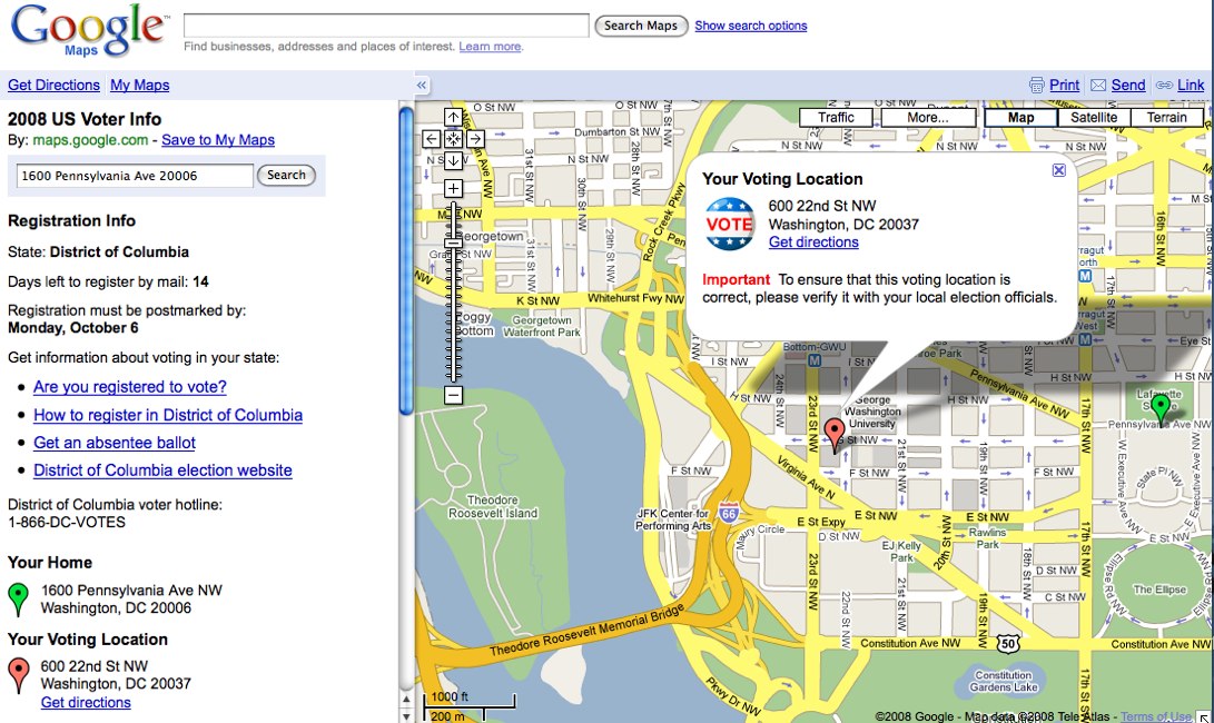
It's hard to believe that in 2008, information so important to U.S. citizens and the democratic process isn't well organized on the web. To solve this problem, we've released our US Voter Info site, an effort to simplify and centralize voting locations and registration information.


We developed the site in the hope that it will increase voter participation. We were helped by a number of partners, including many state and local election officials, the League of Women Voters, the Pew Charitable Trusts, and others involved in the Voting Information Project.

Are you registered to vote? What's the best way to obtain an absentee ballot? When people visit the site, answers to these questions appear. And anyone with a website can provide the same information. The US Voter Info gadget places a simple search box that expands to show a full set of voter information when someone enters an address.

We are also offering a simpler way to find out where to vote. By entering a home address, citizens across the country will be able to find their polling place for election day.

To encourage political participation, we've opened up this data to third-party sites and developers through an API developed by Dan Berlin, one of our open-source engineers. We're excited to share this data, and hope that others will find it useful in encouraging citizens to vote.

Organizing information is our mission. We do that every day with web content, and we want to do the same thing with information to inform and empower voters and to help them get to the polls this election season.

Posted by Abe Murray, Product Manager and Brittany Bohnet, Google Elections Team
Read More
Posted in | No comments

Monday, 20 October 2008

Bioneers, Day Two

Posted on 14:20 by Unknown

Sunday’s plenary sessions at Bioneers brought more people from all over the globe into one room to collectively vocalize the issues they’re most passionate about. Lucas Benitez from the Coalition of Immokalee Workers left Mexico at age 14 to work in the fields in the US, and ha
s used hunger strikes and labor camps to bring large fast-food restaurant chains to the negotiating table to end modern-day slavery. Christine Loh, from Hong Kong’s environmental group Civic Exchange, discussed how the US should set a sustainable example while China develops. Naomi Klein, author of The Shock Doctrine: The Rise of Disaster Capitalism, examined the implications of the $700bn bailout plan, and Congressmembers and average citizen’s responsibility in regulating our newest acquistions, the financial institutions. Among these agents of change, Rebecca Moore from Google Earth Outreach flew people over the Santa Cruz Mountains, where she used Google Earth to stop a logging proposal in her neighborhood. She then flew over Appalachia, where you can look at Appalachian Voices' historical imagery of the mountains and compare it to how the mountains look today. Coal mining companies have blasted up to 800ft off the tops of the mountains. It's pretty shocking if you haven't seen it before, and now everyone can see it in Google Earth. See it for yourself here.

In the afternoon, Google Earth Outreach presented on two panels: the first dove deeper into Appalachian Voices' use of Google Earth and Maps with Mary Anne Hitt, the Executive Director of Appalachian Voices, and showed how Sylvia Earle, Founder of Deep Ocean Exploration and Research (DOER), has used Google Earth for marine conservation. John Gardiner also discussed the development of the Dreaming New Mexico visualization project, done in collaboration with Bioneers, Peter Warshall, Chantal Foster and Alex Sielicki. The second panel featured the Neighborhood Against Irresponsible Logging group, who are celebrating their recent win, defeating a logging proposal in the Santa Cruz Mountains.

Stay tuned for an update about the post-workshop intensive training session where public benefit groups are learning to use Google Earth and Maps to make the world a better place.


Posted by Tanya Keen, Google Earth Outreach
Read More
Posted in Outreach | No comments

Sunday, 19 October 2008

Google Earth Outreach connects with Bioneers

Posted on 11:39 by Unknown
Hello from Bioneers! For the past two days, Google Earth Outreach has been at the 2008 Bioneers conference in San Rafael, CA. The annual conference brings together non-profit and public benefit groups from all over the country for three days packed with talks, booths, music, films, food, and other fun-filled activities.
Google Earth Outreach is manning a computer lab at the conference, where attendees can stop by to get an introduction to Google Earth, and learn how they can use it in their work. During the day Friday and Saturday, we met individuals from the Women's Forest Sanctuary, Nonviolent Peaceforce, Ocean Conservancy, and numerous community and non-profit organizations from all over the country. We gave individual and group demos - how to create a Google My Map and add data in Google Earth. We also demoed a lot of different Google Earth projects by NGOs, including the new Bioneers project, Dreaming New Mexico, which has an amazing Google Earth Plug-in site developed by Googler John Gardiner in his 20% time.


We also saw interesting things like the Bag Monster


and a giant rotating globe!


This morning, Sunday, Oct. 19th, Rebecca Moore, Manager of Google Earth Outreach, presented during the Bioneers plenary session, followed by two in-depth afternoon sessions highlighting NGO uses of Google Earth. Stay tuned for more!

Posted by Sean Askay, Google Earth Outreach
Read More
Posted in Outreach | No comments

Friday, 17 October 2008

Dreaming New Mexico

Posted on 14:15 by Unknown

Once again, I have the incredible privilege of working with Google Earth
Outreach partners on a 20% project. This weekend, our latest efforts debut at the Bioneers Conference in San Rafael, CA. I've worked on the Dreaming New Mexico initiative, which seeks to encourage the future adoption of clean power generation and to move New Mexico away from the terrible legacy of dirty, polluting power plants. Using the Google Earth plugin, Javascript and KML, I've co-created a presentation that describes the choices available to New Mexicans as they decide what future they want.

I had several objectives working on this. Of course, I very much believe in the mission of Dreaming New Mexico, but I also wanted to create a non-profit presentation that moves compelling content outside of placemark balloons and into web pages. In this way, the Google Earth plugin serves as a visual aid to other exciting content that resides on web pages, outside of Google Earth. In short, I was hoping to turn the usual KML content model inside out and provide an example to the world of this approach.

Posted by John Gardiner, Google Earth Team
Read More
Posted in Outreach | No comments

Maps of the Los Angeles wildfires

Posted on 10:11 by Unknown

Since earlier this week, wildfires driven by strong winds have been destroying land and livelihood across Southern California. Thousands of acres of land have been under threat as firefighters battle against tough conditions and try to bring about containment of the fires.

Several groups have taken the initiative to create their own maps and KML files which show the latest information and provide useful information for affected citizens. The current suite of Earth and Maps visualizations includes:
  • The Los Angeles Times has created this My Map updating us on the latest around San Fernando.
  • The California Governor's Office of Emergency Services has annotated their own maps in conjunction with the Los Angeles Fire Department showing both the Marek and Sesnon fires.
  • Incident Information System created a map, incident reports and fire boundary KML files to download; for example, a KML determining the fire extent.
Whether you're in an impacted (or potentially impacted) area or would like to stay on top of the news, hopefully the maps created by these groups will be of use.

Posted by Phil Verney, Google Earth Community Development
Read More
Posted in | No comments

Wednesday, 15 October 2008

Where in the world is... (Answers)

Posted on 12:30 by Unknown

As usual, great work! I'm always impressed that many blogs out there answer all the questions and manage to find many of the updates I didn't even reference.

Here are the answers to the quiz, and below is a more complete listing of areas updated.

1)  Often referred to as "The Crown of Polish Mountains," this is the highest point in the country.
- The highest point in the country, Sněžka, at 1,602 m (5,262 ft)

2)  A university named after an American revolutionary, patriot, and founding father -- and home to a surprise Final Four team.  
- George Mason University in Fairfax, Virginia

3)  In 1405, the French conqueror Jean de Bethencourt took the island and gave his name to the former capital,  Betancuria, on the west coast (Puerto Rosario took over the mantle as island capital in 1835). The name of the island itself is believed to have come from Bethencourt's exclamation "Que forte aventure!" ("What a grand adventure"). A less romantic explanation is that the name simply means "strong wind".
- Canary Islands - Fuerteventura and Tenerife

4)  This city, located in the rain shadow of the Olympic Mountains, is home to Peninsula College and is the birthplace of football hall of famer John Elway.
- Port Angeles, Washington

5)   
Approximately 80 percent of this state's population lives along the Wasatch Front.
- Utah

6)   
The Industrial Museum is housed in a former silk mill in this city (the start of the Derwent Valley Mills World Heritage Site).
- Derbyshire, England

7)   Interested in movies? Some scenes in the 1999 thriller Double Jeopardy starring Ashley Judd and Tommy Lee Jones were filmed here, notably at the historic courthouse.
- Revelstoke, British Columbia

8)  This city lies on the Arno River and has been called the "Athens of the Middle Ages".
- Firenze (Florence), Italy

9) A tale of three states:
-This state has the highest plunge waterfalls in the country.
Maharastra, India
-One of the greatest batsmen in the world, or the Master Blaster hails from this state. 
Karnataka, India
-The "Mosque of the four minarets is an important monument in this state.
Andhra Pradesh, India

Here is the complete list of updated imagery:
Americas: 
- USA: Port Angeles (WA), Wasilla (AK), Lincoln City (OR), Utah (UT), Fairfax County (VA), Spotsylvania County (VA)
- Mexico: San Luis Potosi and Culican.
- Canada: Revelstoke (BC)

Europe, Middle East, & Africa: 
- England: Lincolnshire, Derbyshire, Hampshire and Devon
- Scotland: Aberdeen
- Spain: Menorca, Fuerteventura and Tenerife (part of Canary Islands) 
- Italy: Florence, Urbina, Capri, Verona, Elba
- Czech Republic: Entire country in high resolution

New 2.5m base imagery for parts of: Mexico, India, Romania, and Australia.

Posted by Nagaraj K, GIS Specialist
Read More
Posted in | No comments

Promenez-vous sur les Champs Elysees...

Posted on 02:30 by Unknown

Having worked on Street View since the early days of the project, it gives me great pleasure to return to Paris this week for the launch of more Street View coverage in my home country.

Earlier this year we launched our first Street View coverage in Europe with the release of the 21 stages of the Tour De France route.  This was very popular with our French Google Maps users and cycling enthusiasts all around the world, so I am now especially excited that we've added coverage for 6 major cities in France: Paris, Lyon, Lille, Toulouse, Marseille and Nice.
 
France is the first country in Europe to benefit from Street View imagery and I'm delighted that many of my favorite places are included in the new coverage, including the street where I grew up, which you can see below. If I ever feel mal du pays (homesick), I can look these places up on Street View now!


View Larger Map

We decided to add coverage for large cities in order to make the product as useful as possible for our French Maps users.  It's also great for people all around the world to catch a glimpse of France in order to plan holidays, to learn about a new place, or to have a chance to see many of the beautiful sites for themselves.

Using Street View, you can now walk down the Champs Elysees, explore the old port of Marseille, journey along La Promenade des Anglais in Nice or take a tour around La Croix Rousse in Lyon. Here's a brief tour of some of my favorite images so far:

Toulouse:

View Larger Map

Paris:

View Larger Map

Lyon:

View Larger Map

Because there are so many, here's a slideshow with even more amazing images:


We look forward to adding Street View coverage for more cities and countries in Europe, and I look forward to my trip down memory lane.

Posted by Luc Vincent, Engineering Director, Street View
Read More
Posted in Street View | No comments

Tuesday, 14 October 2008

Campaigning across Canada

Posted on 11:25 by Unknown

There have been many great My Maps created for the upcoming US elections, which we're featuring in the Google Maps Elections Gallery. There have also been great maps put together for today's elections in Canada. The Globe and Mail, a national newspaper in Canada, has put together a series of My Maps that track the campaigns of candidates as they travel across the country. The latest map chronicles the candidates on election day. 

Posted by Elaine Filadelfo, Lat Long Blog Team
Read More
Posted in | No comments

Monday, 13 October 2008

Where in the world is ...

Posted on 13:39 by Unknown
This month we've published a significant amount of new or updated high resolution satellite imagery for Google Earth. So if you think it is going to be easy to find the new imagery, stop and think again. You are going to have to work a little. We have put together a list of clues about where to find some of our new imagery. Here is one to get you off and running on your Google Earth tour: I would encourage all to go and explore the earth -- you never know what you might see.

1) Often referred to as "The Crown of Polish Mountains," this is the highest point in the country.


2) A university named after an American revolutionary, patriot, and founding father -- and home to a surprise Final Four team.

3) In 1405, the French conqueror Jean de Bethencourt took the island and gave his name to the former capital, Betancuria, on the west coast (Puerto Rosario took over the mantle as island capital in 1835). The name of the island itself is believed to have come from Bethencourt's exclamation "Que forte aventure!" ("What a grand adventure!") A less romantic explanation is that the name simply means "strong wind."

4) This city, located in the rain shadow of the Olympic Mountains, is home to Peninsula College and is the birthplace of football hall of famer John Elway.


The Olympic Mountains in winter, as seen from the east. The Brothers is the large double peak on the left, and Mount Constance is on the right.

5) Approximately 80 percent of this state's population lives along the Wasatch Front.

6) The Industrial Museum is housed in a former Silk Mill in this city (the start of the Derwent Valley Mills World Heritage Site).

7) Interested in movies? Some scenes in the 1999 thriller Double Jeopardy starring Ashley Judd and Tommy Lee Jones were filmed here, notably at the historic courthouse.

8) This city lies on the Arno River and has been called the "Athens of the Middle Ages."

9) A tale of three states:
  • This state has the highest plunge waterfalls in the country
  • One of the greatest batsmen in the world, or the Master Blaster hails from this state
  • The "Mosque of the four minarets is an important monument in this state.

Jog Falls, The Taj and Charminar


Posted by Nagaraj K, GIS Specialist
Read More
Posted in | No comments

Transliteration for Japan

Posted on 11:05 by Unknown

I'll never forget the first time that I'd traveled to Japan, when I'd nearly missed a train because I couldn't make heads or tails of the route markers that displayed city names in kanji, the Chinese-based Japanese character set. Though I'd studied katakana (alphabet for foreign words) and hiragana (alphabet for native words), kanji was entirely different. For starters, they aren't phonetic like the other two but more conceptual (e.g. ideograms or pictograms). What's more, there are thousands of them. Last count was in the tens of thousands. The problem for me, of course, was that geographic names are written in kanji.

Fast forward to this past summer when I returned to Japan and tried to plan my route to the Tokyo Google office using Google Maps. Again, I couldn't make sense of the subway station names. Well, this time I could do something about it. This week we will be releasing English labels of city names, prefectures, districts and transit station names in Japan. We have used a combination of transliteration (local pronunciation into English alphabet) and translation so that "Shibuya Eki" would read as "Shibuya Station", for example. We thought it would be more helpful to transliterate the name but let users know the difference between a city or a station. We've even used macrons so "Tokyo" reads as "Tōkyō" to help with pronunciation.

As it turns out, I wasn't the only one having problems reading kanji. Users have been asking for this for a long time. Back in February, the Maps team got the ball rolling with major city names and now, we're working towards adding more English labels. In the future, you can look forward to additional coverage with street names and other points of interest.

before

after

Posted by Linne Ha, International Program Manager
Read More
Posted in | No comments

Friday, 10 October 2008

Don't forget: Academic Developers Conference

Posted on 13:25 by Unknown

A reminder to all of you interested in cutting edge applications for Google Earth and Google Maps: Google is co-sponsoring a conference with the University of Michigan on October 22nd and 23rd. Researchers, entrepreneurs, faculty, and students from all over the country will be attending to discuss new projects, learn about data visualization techniques, and get first-hand access to Google Earth engineers.

Focus groups include:

Astronomy
Planetary science
Public policy
Demographics
Medical disease tracking
Disaster response
Archeology
Climate change
Geosciences
Science Education
Urban Planning
Weather

Speakers and presenters include:
  • Tim Killeen, Assistant Director for Geosciences at the National Science Foundation
  • Dan Adkins, former Director of the National Science Foundation Cyberinfrastructure
  • Sean Askay, Google Earth Outreach Evangelist
  • Michael Weiss-Malik, KML Product Manager
  • Mano Marks, Google Geo Developer Advocate
  • Noel Gorelick, Google Sky Tech Lead

Registration is open until October 17th so make sure you register soon.  To register and find out additional details about the event, including travel information and agenda, go to GoogleEarthConference.engin.umich.edu.

Posted by Ryan Falor, Systems Engineer
Read More
Posted in | No comments

Thursday, 9 October 2008

Tip of the week: Viewing KMLs in Google Maps

Posted on 20:30 by Unknown

We post a bunch of KML and KMZ files on this blog, and usually tell you to download the file then open it with Google Earth. But don't forget that you can also open KML or KMZ files in Google Maps, and without a download. To open, just paste a URL hosting the file into the Maps search box and click 'Search'. (You can find the the URL by right-clicking on one of our links to a KML/KMZ, instead of downloading it). You can find more detail about what KML content is viewable in Google Maps in the Help Center, but this trick should come in handy for most of the files you find us talking about on the blog. For example, last year we blogged about a KML of air emissions created by the EPA -- and here it is in Google Maps!
 
Posted by Elaine Filadelfo, Lat Long Blog Team
Read More
Posted in Tip of the week | No comments

Wednesday, 8 October 2008

Maps for Android

Posted on 14:27 by Unknown

For anyone interested in details about what to expect from Google Maps on the Android-powered T-Mobile G1 phone, head over to the Google Mobile Blog. You can find out how the navigation works, how the maps application integrates with other applications, and even read more about the cool Compass mode. The post is a great preview of what's to come.

Posted by Elaine Filadelfo, Lat Long Blog Team
Read More
Posted in Mobile | No comments

Getting around your neighborhood with Google Maps

Posted on 11:05 by Unknown

When I moved to the Bay Area last year, everything was new to me. I didn't know Los Altos from Los Gatos, good eateries in my neighborhood, or how to get to where I wanted to go. Whether you're moving to a new area, traveling to a new place, or simply exploring a new part of town, this may sound familiar to a lot of people.

There's a simple solution: turn to Google Maps to find local information. We've gathered a lot of useful info about local businesses so you can find everything you need in one place. You can find neighborhoods and see if they're close to downtown, parks or other places of interest. If you're moving into a new home, you can look for nearby supermarkets, hardware stores, restaurants and other places that will help you settle in. Almost every business listing includes the phone number, website, store hours, price and more. Most also have user reviews and photos. 

And it turns out I wasn't the only one who turned to Google Maps to learn more about my town. Watch this video to see how Google Maps helped Ryan, a fellow newcomer to the Bay Area:


Even if you know your hometown like the back of your hand, odds are you'll want to go somewhere new at some point. Not only can you find out the address of a specific location and get directions to it before even heading out the door, but you can virtually explore the neighborhood with Street View (available in many cities in the U.S., Japan, and Australia), or check out live traffic conditions. You can also use the "Send" feature of Google Maps to text the address to your phone or email directions to friends.

Watch this video to see all the things you can do:


And don't forget, with Google Maps for mobile, you can access all of this great information on the go. To learn more about using Google Maps to find local information, visit http://maps.google.com/golocal.

Posted by Cathy Tang, Associate Product Marketing Manager
Read More
Posted in | No comments

Tuesday, 7 October 2008

Adding another dimension to your city

Posted on 14:15 by Unknown

Your downtown is so much more than an address listing of the businesses in it. What if there were a way for someone to discover their new favorite bookstore, within easy walking distance of
the parking garage, with a coffee shop next door and a kids' play area a block away, all at once? What if you could plan a walking tour of all the historic buildings downtown, and in the process discover that there's an ice cream parlor and a pottery shop that you just have to visit along the way? There's a way to do all these things, and it's easier than you think.

Google Earth has a Photorealistic 3D Buildings layer that
you can use to host 3D models of the buildings in your downtown annotated with a wide variety of information that people might find useful. Because it's a full, navigable 3D environment, you can go on a virtual tour and get a much better feel for the city than you might from a traditional map. You can click on a building to pull up an information bubble that might contain anything from descriptions of the stores in the building to photographs of the merchandise to a description of the building itself, its construction date, and architect. You're in control of both the model and the information attached to it; you can update it with links to events happening in the area, sample restaurant menus, or websites associated with a retail store.

With a complete set of 3D models, you can even use Google Earth for city planning. Is that side street really as pedestrian-friendly as you want it to be? If I approach downtown from this bus stop, do I have a clear idea of where I should go to get to the central square?

Apart from the benefits for visitors wanting to search, browse, and explore your city, right now there's an added reason to put your 3D downtown on the map. Photo-textured, publicly-available 3D building models are still novel enough to create buzz, as the city of McMinnville, TN discovered. The idea of using the 3D models as a jumping-off point to a wide variety of content is even more compelling; Walt Disney's recent release of their Orlando theme parks and resorts really shows the potential for interactive models in Google Earth. With the new Google Earth Browser Plugin you can even place tours of your 3D models on your city's website where people explore them without needing a Google Earth client. Your city could be on the leading edge of the virtual tourism market!

If you're thinking this sounds good, but difficult and/or expensive, don't fret. There are lots of free tools to get you started. Google SketchUp is an easy-to-use 3D modeling program that you can use to construct the architectural models and apply photographs to them to generate photorealistic buildings. It's free to download, and there are lots of tutorials available to help you learn the program, and specifically to help you construct a model that's optimized for Google Earth. You can then upload your model to the 3D Warehouse, add descriptive information, and mark it for inclusion in the "Photorealistic" 3D Buildings layer in Google Earth. Alternately, your city GIS department may already have models of your downtown that you can start with; or you may want to use some other software package to build your models. If you'd prefer not to upload your models using Google's 3D Warehouse, you can contact the team behind the Cities in 3D program to learn about another way to add your models to Google Earth.

Happy modeling!

Posted by Allison Floyd, Software Engineer
Read More
Posted in | No comments

Let's map Africa

Posted on 11:30 by Unknown
[cross-posted from the Google Africa Blog]

We are excited to announce that users may now build and edit maps in Map Maker for 45 new African countries, bringing the total number of countries covered in Map Maker to 122 countries, covering a population of 3 billion people. The Map Maker team is very excited about this announcement as Africa symbolizes our dream - to bring rich, deep map and local data to places that had none. Having good maps and local data spurs investment, local commerce and planning. Many NGOs also depend on a good base map to plan and execute their work. So much so that many NGOs have told us that they either cannot do their work without good maps or have to spend a lot of effort building these.

However, we need your help. With Map Maker, any user can create or edit map data including schools, buildings, local businesses, national parks, trails and safaris. If you have strong local knowledge, this is your chance to make a little difference.

The countries enabled for editing today are: Algeria, Angola, Benin, Botswana, Burkina Faso, Burundi, Cameroon, Central African Republic, Chad, Congo, Côte d'Ivoire, Democratic Republic of the Congo, Djibouti, Equatorial Guinea, Eritrea, Ethiopia, Gabon, Gambia, Ghana, Guinea-Bissau, Kenya, Lesotho, Liberia, Libya, Malawi, Mali, Mauritania, Mauritius, Morocco, Mozambique, Namibia, Niger, Nigeria, Rwanda, Senegal, Sierra Leone, Somalia, Sudan, Swaziland, Tanzania, Togo, Tunisia, Uganda, Morocco (including Western Sahara), Zambia, Zimbabwe. And don't forget that you can also edit the several other countries in Africa that were made available in August: Cape Verde, Comoros, Madagascar, Reunion, São Tomé and Príncipe and Seychelles.

We leave you with an image of Nairobi, Kenya, where Google MapMaker has been working on a project in partnership with a team of seven students from three Kenyan universities to create better online maps for this region.


Posted by Lalitesh Katragadda, Software Engineer and Sanjay Jain, Product Manager
Read More
Posted in Map Maker | No comments

Thursday, 2 October 2008

Opening the door to geospatial data

Posted on 08:30 by Unknown
[This post recently appeared on the new Content Central blog; it's a great look where some of our geospatial data comes from and how organizations can share data with us. -Ed.]

Have you ever wondered how your organization could add your geospatial data, such as aerial imagery or places of interest, to Google Maps and Google Earth? Maybe you're using the Google Maps API and want to enrich our basemap with your own data. Or perhaps you'd just like to expand the reach of your organization's investment in GIS (geospatial information systems) by putting this data in places where people in your community are more likely to encounter it. You are not alone.

Some of us in Google's Public Sector Content Partnerships team attended the recent ESRI International User Conference where we met hundreds of local government GIS managers and others who eat, sleep and breathe GIS data. There was one comment we heard over and over: "We'd like to share data with Google, but we don't know how to contact anyone there."

Admittedly, we haven't done a great job of explaining how to get your GIS data into Google's services--like what types of data we welcome and in which formats and at what quality level. But we're working on it, as you'll see in two these examples:

Earlier this year we introduced the Cities in 3D Program through which we invite local governments, community groups and educational institutions to take ownership of the 3D representation of their community on Google Earth. In a video tour of "Cities in 3D"and case studies of successful 3D modeling projects, this site makes the case for producing and sharing 3D models as a tool for planning and economic development, for fostering tourism or merely to simplify navigation. The site, which was recently made available in multiple European languages, also explains the steps toundertaking a 3D modeling project and includes a spec of the various data formats we welcome. And, of course, the Cities in 3D program site includes a contact form where an organization can tell us about 3D data (as well as aerial imagery and terrain data) they'd like to share.


Another example of how we're opening the door to making GIS data available to Google users is the Voting Information Project. Google is a founding partner in this initiative to make it easier for voters in the U.S. to find information online about registering to vote, locating a polling place, and knowing what to expect when you get there. Thanks to data shared by election officials in a growing number of jurisdictions, we're now able to point voters to their polling place on Google Maps and provide other relevant voting info.


So, the door is open. If your organization has 3D data to share, or would be interested in learning how to produce a 3D model of your community, we'd like to hear from you. If your organization provides official election information, including polling places, and you would like to ensure voters in your jurisdiction can readily find this info on Google Maps, check out the Voting Information Project's open format for election data sharing and let the VIP team know what you have to offer. And if you've got other GIS data types to share, just tell us about your interest at gisdata@google.com or stay tuned to the Content Central blog as we offer additional information about how to add your GIS data to Google services.

Posted by JL Needham, Manager of Public Sector Content Partnerships
Read More
Posted in | No comments
Newer Posts Older Posts Home
Subscribe to: Posts (Atom)

Popular Posts

  • In their own words
    Posted by Cathy Tang, Product Marketing Manager We're always amazed by the innovative ways businesses use Google Maps to improve their p...
  • The aftermath of Hurricane Ike
    Three days after Hurricane Ike slammed into Galveston, Texas as a Category 2 hurricane, severe flooding has challenged Gulf Coast residents ...
  • Making Maps and Earth Global
    Posted by Adam Smith, Geo Product Manager To have a truly global product, you need engineers from around the world to make it happen. Over t...
  • Every percent counts
    Posted by Chris Harrelson, Software Engineer, Google Transit The Google Transit team has been busy lately. In the last few weeks alone we...
  • Build Your Campus in 3D Competition - the results are in!
    Posted by Allyson McDuffie, Education Program Development Congratulations to the winners of Google’s Build Your Campus in 3D Competition ! A...
  • See which campuses received an A+
    Posted by Allyson McDuffie, SketchUp for Education Program Manager We are happy to announce the winners for the Google 2008 Internat...
  • Citizen journalism meets My Maps
    Posted by Jessica Lee, Product Manager I've noticed that lots of people are using My Maps to document breaking news and current events f...
  • We gotta start makin' changes
    Today we are relaunching one of our oldest and most popular Global Awareness layers, the Altas of Our Changing Environment by the United Na...
  • December Updates in Google Earth
    Posted by Wei Luo, Senior GIS Specialist Here's good news for the international folks: we've just added roads and business listings ...
  • YouTube-style Embeddable Maps
    Posted by Jess Lee, Product Manager, Google Maps Today we're excited to announce a new feature on Google Maps that allows you to add map...

Categories

  • gadgets
  • Map Maker
  • Mobile
  • Outreach
  • Quiz
  • real estate
  • Street View
  • Tip of the week
  • Transit

Blog Archive

  • ►  2009 (11)
    • ►  January (11)
  • ▼  2008 (257)
    • ►  December (17)
    • ►  November (16)
    • ▼  October (27)
      • Introducing Google.org Geo Challenge Grants
      • How the US has voted since 1980
      • La Dolce Vista - Street View comes to Italy
      • Getting around Montréal, past and present
      • Un paseo por España
      • Google Earth now available for iPhone
      • A note on election information
      • Tip of the week: Frightfully fun My Maps
      • Bioneers, Day Three
      • Greater access to voting information
      • Bioneers, Day Two
      • Google Earth Outreach connects with Bioneers
      • Dreaming New Mexico
      • Maps of the Los Angeles wildfires
      • Where in the world is... (Answers)
      • Promenez-vous sur les Champs Elysees...
      • Campaigning across Canada
      • Where in the world is ...
      • Transliteration for Japan
      • Don't forget: Academic Developers Conference
      • Tip of the week: Viewing KMLs in Google Maps
      • Maps for Android
      • Getting around your neighborhood with Google Maps
      • Adding another dimension to your city
      • Let's map Africa
      • Opening the door to geospatial data
      • Now's the time: register to vote
    • ►  September (33)
    • ►  August (16)
    • ►  July (20)
    • ►  June (17)
    • ►  May (25)
    • ►  April (30)
    • ►  March (16)
    • ►  February (25)
    • ►  January (15)
  • ►  2007 (137)
    • ►  December (19)
    • ►  November (27)
    • ►  October (26)
    • ►  September (13)
    • ►  August (14)
    • ►  July (13)
    • ►  June (11)
    • ►  May (14)
Powered by Blogger.

About Me

Unknown
View my complete profile