Trekkers

  • Subscribe to our RSS feed.
  • Twitter
  • StumbleUpon
  • Reddit
  • Facebook
  • Digg

Thursday, 2 October 2008

Opening the door to geospatial data

Posted on 08:30 by Unknown
[This post recently appeared on the new Content Central blog; it's a great look where some of our geospatial data comes from and how organizations can share data with us. -Ed.]

Have you ever wondered how your organization could add your geospatial data, such as aerial imagery or places of interest, to Google Maps and Google Earth? Maybe you're using the Google Maps API and want to enrich our basemap with your own data. Or perhaps you'd just like to expand the reach of your organization's investment in GIS (geospatial information systems) by putting this data in places where people in your community are more likely to encounter it. You are not alone.

Some of us in Google's Public Sector Content Partnerships team attended the recent ESRI International User Conference where we met hundreds of local government GIS managers and others who eat, sleep and breathe GIS data. There was one comment we heard over and over: "We'd like to share data with Google, but we don't know how to contact anyone there."

Admittedly, we haven't done a great job of explaining how to get your GIS data into Google's services--like what types of data we welcome and in which formats and at what quality level. But we're working on it, as you'll see in two these examples:

Earlier this year we introduced the Cities in 3D Program through which we invite local governments, community groups and educational institutions to take ownership of the 3D representation of their community on Google Earth. In a video tour of "Cities in 3D"and case studies of successful 3D modeling projects, this site makes the case for producing and sharing 3D models as a tool for planning and economic development, for fostering tourism or merely to simplify navigation. The site, which was recently made available in multiple European languages, also explains the steps toundertaking a 3D modeling project and includes a spec of the various data formats we welcome. And, of course, the Cities in 3D program site includes a contact form where an organization can tell us about 3D data (as well as aerial imagery and terrain data) they'd like to share.


Another example of how we're opening the door to making GIS data available to Google users is the Voting Information Project. Google is a founding partner in this initiative to make it easier for voters in the U.S. to find information online about registering to vote, locating a polling place, and knowing what to expect when you get there. Thanks to data shared by election officials in a growing number of jurisdictions, we're now able to point voters to their polling place on Google Maps and provide other relevant voting info.


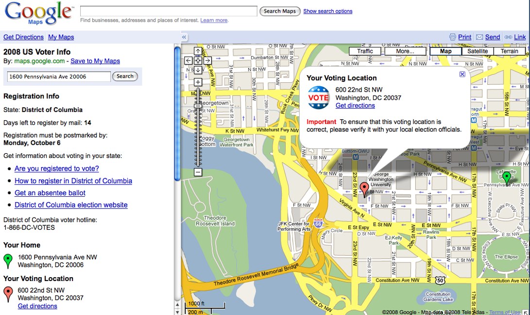
So, the door is open. If your organization has 3D data to share, or would be interested in learning how to produce a 3D model of your community, we'd like to hear from you. If your organization provides official election information, including polling places, and you would like to ensure voters in your jurisdiction can readily find this info on Google Maps, check out the Voting Information Project's open format for election data sharing and let the VIP team know what you have to offer. And if you've got other GIS data types to share, just tell us about your interest at gisdata@google.com or stay tuned to the Content Central blog as we offer additional information about how to add your GIS data to Google services.

Posted by JL Needham, Manager of Public Sector Content Partnerships
Email ThisBlogThis!Share to XShare to Facebook
Posted in | No comments
Newer Post Older Post Home

0 comments:

Post a Comment

Subscribe to: Post Comments (Atom)

Popular Posts

  • Helpful maps for the Inauguration
    There is most definitely a buzz in the air.  Hundreds of thousands of people are streaming into Washington D.C. to see Barack Obama sworn in...
  • Virtually experience the Inauguration
    Earlier today, we posted some tips about how to use Google Maps to be prepared for tomorrow's Inauguration. Well, for those who aren...
  • Google Maps Mashups 2.0
    Posted by Thai Tran, Product Manager When we were building the original Google Maps site, we envisioned that it would eventually become a pl...
  • Build Your Campus in 3D Competition - the results are in!
    Posted by Allyson McDuffie, Education Program Development Congratulations to the winners of Google’s Build Your Campus in 3D Competition ! A...
  • Become a Google Earth Pro Expert!
    Posted by James Therrien, Training Manager A lot of people have been asking about ways they can familiarize themselves with the Google Earth...
  • The aftermath of Hurricane Ike
    Three days after Hurricane Ike slammed into Galveston, Texas as a Category 2 hurricane, severe flooding has challenged Gulf Coast residents ...
  • It's easy being green
    Posted by Christopher Barry, Senior Vice President, Digital Media and Business Strategy, Sundance Channel Here at the Sundance Channel, we r...
  • Where in the world is... (Answers)
    Posted by Matt Manolides, GIS Specialist Here are the answers to yesterday's quiz -- I'm sure you all passed with flying colors. 1)...
  • Google for non-profits
    Posted by Steve Miller, Google Earth Outreach As a part of our Google Earth Outreach efforts, we speak with a number of organizations about...
  • Where in the world is...
    Posted by Matt Manolides, GIS Specialist Today I'm happy to announce that we've just finished pushing out an imagery update for all ...

Categories

  • gadgets
  • Map Maker
  • Mobile
  • Outreach
  • Quiz
  • real estate
  • Street View
  • Tip of the week
  • Transit

Blog Archive

  • ►  2009 (11)
    • ►  January (11)
  • ▼  2008 (257)
    • ►  December (17)
    • ►  November (16)
    • ▼  October (27)
      • Introducing Google.org Geo Challenge Grants
      • How the US has voted since 1980
      • La Dolce Vista - Street View comes to Italy
      • Getting around Montréal, past and present
      • Un paseo por España
      • Google Earth now available for iPhone
      • A note on election information
      • Tip of the week: Frightfully fun My Maps
      • Bioneers, Day Three
      • Greater access to voting information
      • Bioneers, Day Two
      • Google Earth Outreach connects with Bioneers
      • Dreaming New Mexico
      • Maps of the Los Angeles wildfires
      • Where in the world is... (Answers)
      • Promenez-vous sur les Champs Elysees...
      • Campaigning across Canada
      • Where in the world is ...
      • Transliteration for Japan
      • Don't forget: Academic Developers Conference
      • Tip of the week: Viewing KMLs in Google Maps
      • Maps for Android
      • Getting around your neighborhood with Google Maps
      • Adding another dimension to your city
      • Let's map Africa
      • Opening the door to geospatial data
      • Now's the time: register to vote
    • ►  September (33)
    • ►  August (16)
    • ►  July (20)
    • ►  June (17)
    • ►  May (25)
    • ►  April (30)
    • ►  March (16)
    • ►  February (25)
    • ►  January (15)
  • ►  2007 (137)
    • ►  December (19)
    • ►  November (27)
    • ►  October (26)
    • ►  September (13)
    • ►  August (14)
    • ►  July (13)
    • ►  June (11)
    • ►  May (14)
Powered by Blogger.

About Me

Unknown
View my complete profile